
24.04.2024
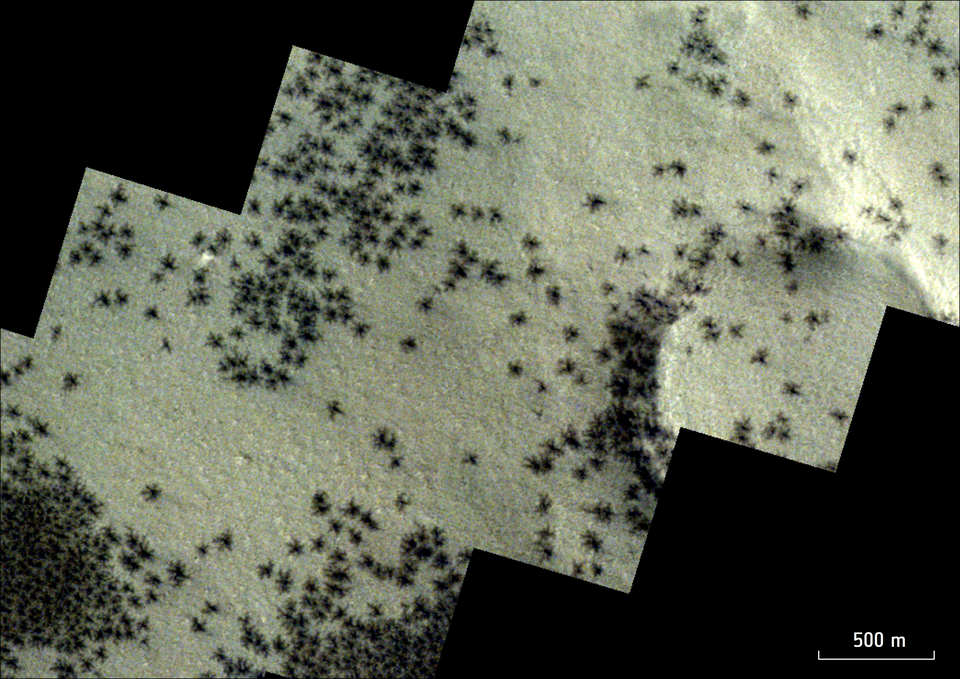
No sign of Ziggy Stardust – but ESA’s Mars Express has snapped the telltale traces of ‘spiders’ scattered across the southern polar region of Mars.
Rather than being actual spiders, these small, dark features form when spring sunshine falls on layers of carbon dioxide deposited over the dark winter months. The sunlight causes carbon dioxide ice at the bottom of the layer to turn into gas, which subsequently builds up and breaks through slabs of overlying ice. The gas bursts free in martian springtime, dragging dark material up to the surface as it goes and shattering layers of ice up to a metre thick.
The emerging gas, laden with dark dust, shoots up through cracks in the ice in the form of tall fountains or geysers, before falling back down and settling on the surface. This creates dark spots of between 45 m and 1 km across. This same process creates characteristic ‘spider-shaped’ patterns etched beneath the ice – and so these dark spots are a telltale sign that spiders may be lurking below.
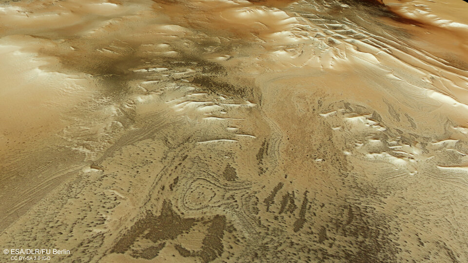
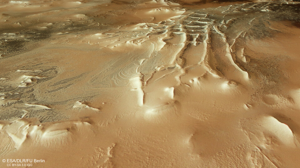
Another of ESA’s Mars explorers, the ExoMars Trace Gas Orbiter (TGO), has imaged the spiders’ tendril-like patterns especially clearly (see below). The spiders captured by TGO lie near, but outside, the region shown in this new Mars Express image. The Mars Express view shows the dark spots on the surface formed by escaping gas and material, while the TGO perspective also captures the spidery, web-like channels that are carved into the ice below.
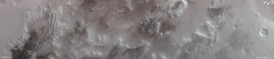
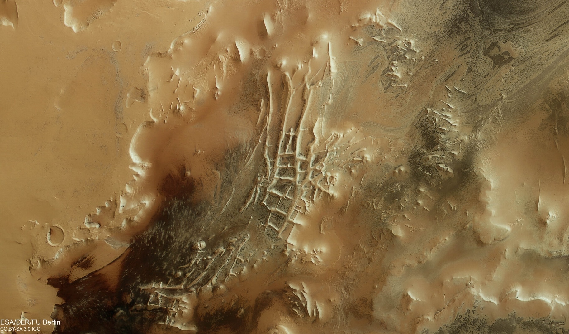
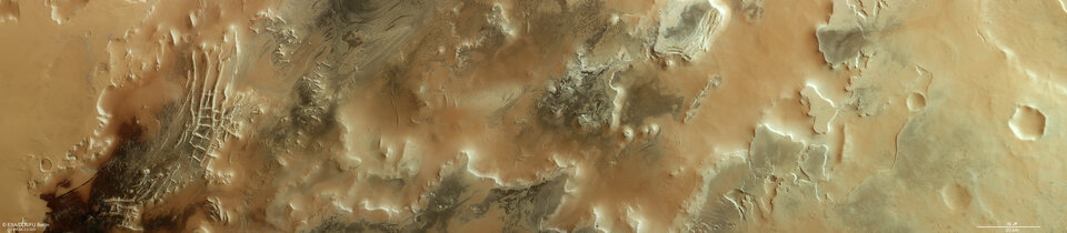
The aforementioned dark spots can be seen all over the Mars Express image, creeping across towering hills and expansive plateaus. However, most can be seen as small spots in the dark region to the left, which sits just at the outskirts of a part of Mars nicknamed Inca City. The reason for this name is no mystery, with the linear, almost geometric network of ridges being reminiscent of Inca ruins. More formally known as Angustus Labyrinthus, Inca City was discovered in 1972 by NASA’s Mariner 9 probe.
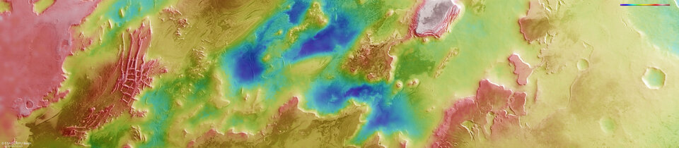
This new view of Inca City and its hidden arachnid residents was captured by Mars Express’s High Resolution Stereo Camera. A version with labels is also available; click on the image below to explore the region and discover more about the different features you can see here.
A mysterious origin
We’re still not sure exactly how Inca City formed. It could be that sand dunes have turned to stone over time. Perhaps material such as magma or sand is seeping through fractured sheets of martian rock. Or, the ridges could be ‘eskers’, winding structures related to glaciers.
The ‘walls’ of Inca City appear to trace part of a large circle, 86 km in diameter. Scientists therefore suspect that the ‘city’ sits within a large crater that itself formed as a rock from space crashed into the planet’s surface. This impact likely caused faults to ripple through the surrounding plain, which were then filled with rising lava and have since worn away over time.
Towards the middle section of the image the landscape changes somewhat, with large roundish and oval swirls creating an effect reminiscent of marble. This effect is thought to occur when layered deposits are worn away over time.
To the right-centre of the frame lie a few prominent steep-flanked, flat-topped mounds and hills that rise up for more than 1500 m above the surrounding terrain. These form as softer material is eroded over time by flows of wind, water or ice, leaving behind the harder material that forms these hills.
The ground towards the right (north) becomes increasingly covered in smooth, light-coloured dust. Some signs of spiders can be seen scattered across the plateaus here, lurking amongst various canyons and troughs.
Exploring Mars
Mars Express has revealed a great deal about Mars in the last two decades and counting. The orbiter continues to image Mars’s surface, map its minerals, explore the composition and circulation of its atmosphere, probe beneath its crust, and study the martian environment.
The spacecraft’s HRSC has shown us everything from wind-sculpted ridges and grooves to sinkholes on the flanks of colossal volcanoes to impact craters, tectonic faults, river channels and ancient lava pools. The mission has been immensely productive over its lifetime, creating a far fuller and more accurate understanding of our planetary neighbour than ever before.